


Extended daylight in the summer months allow hikers and climbers to get outside for some after-work training hikes near Seattle. Since I’ve been training for a couple months now, I want to share a list of trails to gain elevation around the I-90 corridor.
I believe in training outside for my adventures when possible because the uneven ground, fresh air, and views make the experience better than clocking mileage on a treadmill or stair machine. But hey, sometimes you use what you have and I’m lucky to be within close driving distance to the Central Cascades.
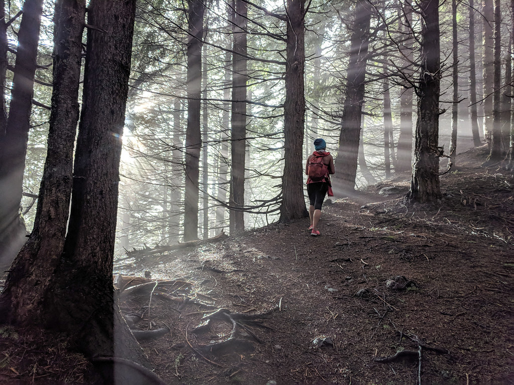
Training tips
I start with 8 to 10 pounds of weight in my backpack. I fill up Nalgene water bottles. Each 1 liter bottle weighs roughly 2.2 pounds when filled with water. I try to carry water weight because 1) I can drink it and 2) I can dump it out after the elevation gain to save my knees on the way down. I aim at one after-work training hike a week in addition to at least one weekend day adventure.
My goal was to hike 3 to 4 miles and 3,000 to 4,000 feet of elevation with 30 pounds in under two hours and feel good after. Most of the time, my mountaineering backpack can weight between 35 and 50 pounds.
Keeping track of my training helps me evaluate. I don’t do anything fancy but log the date, mileage, elevation, and weight. Keeping the details in one place provides a view of how often I’m exercising, along with the amount of effort. Feel free to add notes to each training hike on how you felt after. Tracking shows where you started and where you’re ending. You may want to increase intensity or frequency if your physical endurance isn’t improving.
PIN this image to a Pinterest board for future reference.
Note: This post contains affiliate links. Meaning if you click and buy some of the products linked in this post, I may earn a small percentage at no extra cost to you.
Know before you go
Snow can remain on some trails well into June and July, so plan accordingly and read recent trip reports. I’ll continue to add to the list as I continue to try to find new trails
Don’t forget your parking passes. Check before you go and make sure you have a Discover Pass or Northwest Forest Pass
Warning: At any trailhead, hide or take all your valuable items as vandalism can happen.
Note: The mileage and elevation were recorded by my GPS and may vary slightly to the actual trail stats.
Sign up for Gaia GPS Membership to download maps offline, plan, and navigate.
Issaquah Alps
Cable Line Trail-West Tiger 3 Loop – 5.0 miles, 1,941 feet elevation gain

Its close proximity to the highway and Seattle, Cable Line Trail makes for a good after work hike taking only a few hours with options to take the less steep West Tiger 3 on the way down to save your knees on a gradual trail.
Section Line Trail via High School Trail – 5.8 miles, 2,209 feet elevation gain

Looking for another option to Cable Line Trail, I stumbled upon the Section Line Trail. A less-traveled trail with steep elevation gain. However, the trail starts halfway up the mountain, so some navigation of local trails to get to the start needs to happen. I connected the High School Trail to the Section Line Trail but a branch heading to Poo Poo Point can be another but longer option. End at the top at Tiger West that shares the summit with the Cable Line and West Tiger #3 trails.
North Bend
Old Si Trail – 6.6 miles, 3,223 feet elevation gain
Start at the Little Si parking lot and continue a short distance before taking a right junction off the Little Si Trail to the Boulder Garden Loop. Climb several switchbacks until passing the Douglas Fir Trail to the right. Take the second right to continue on the Old Si Trail, left continues on Boulder Garden Loop. At 3,720 elevation, the Old Si Trail joins with the Mount Si Trail before reaching the top.
Mount Si Trail – 8 miles, 3,270 feet elevation gain

The Mount Si Trail is a go-to for my training purposes, but I’ve been searching for variety in the area lately. During the weekday, the Si doesn’t see the weekend traffic and is tolerable. The trail is straightforward and little planning needs to go into hiking.
Mount Washington Trail – 8.5 miles, 3,134 feet elevation gain

Be prepared with a map for this one. Starting at the XXX trailhead in Olallie State Park, the trail climbs steep until hitting a gravel road (the John Wayne Pioneer Trail). After, go a distance down the road to the right before turning back into the trees with a gradual climb up to the summit. Follow the signs, some with handwritten arrows to follow to stay on the trail. Pass many trail junctions that lead to rock climbing routes.
Teneriffe Falls and Mount Teneriffe Loop – 10 miles, 4,192 feet elevation gain
Bring your headlamp while getting in the mileage and elevation for this one. The hike gets steep to Teneriffe Falls before reaching Mount Tenerife. Save the knees by taking the gradual path down.
Mailbox Peak – Old to New Loop – 7.9 miles, 3,825 feet elevation gain

A popular weekend hike outside of Seattle, the Old Trail is steep and can be hard to follow before the trails merge in the alpine. The mailbox can be filled to the brim or empty depending on the time of year and week you hike, but the mailbox makes the hike an objective. I enjoy making a loop hike to change up the scenery with climbing up the steep, shorter distance and descending the New Trail with gradual switchbacks. On a clear day, Rainier appears on the southern horizon.
McClellan Butte – 10 miles, 3,629 feet elevation gain

McClellan Butte varies from the other listed hikes with an option to scramble up the to the peak. The trail is steep and has views of I-90 at the top. The milage makes for a more gradual climb but you still get a workout. Best not to scramble if snow is present.
Snoqualmie Pass
Snoqualmie Mountain – 3.8 miles, 3,105 feet elevation gain

Parking at the Alpental Ski Resort parking lot, find the start of the Snow Lake trail but immediate walk through a small trail to the right through the field. The trail can be steep and rocky so proper traction is advised until the snow melts.
Guye Peak – 6 miles, 2,100 feet elevation gain

A similar start to Snoqualmie Mountain, continue on the same trail until you reach a boulder field. Instead of continuing on the trail to Snoqualmie Mountain, veer right through the rocky terrain and hike cairn to cairn to find the trail to a pass before the last scramble up Guye Peak. Combine them together for an extra workout.
If you like this post, please share it. Follow me on Facebook, Instagram, Pinterest, or Twitter (pick your poison).